der Weichsel: Historic Problems
by Otto Bergman
On pages 22 and 23 of Danzig Report No. 67, three similar map areas were illustrated of East Prussia’s separation of the Weichsel River. Readers may be interested to learn more about the Weichsel that empties into the Baltic at Danzig.
The Weichsel (Vistula in English, Wista in Polish) River flowed through West Prussia for about 140 miles on its way to the Baltic Sea. Its origin is the Carpathian Mountain range to the south of Auschwitz (present-day Oswiecim, Poland). After passing through Auschwitz, it basically flows northward through Cracow, Warsaw, Graudenz, Marienwerder and finally to the Baltic Sea at Danzig. Of its entire length of 630 miles, approximately half of its length flowed through West Prussia.
Controlling the flooding of the West Prussian lowlands by the Wejchsel River was difficult since the river flowed through three countries: Austria-Hungary, Russia and Germany. Estensive spring flooding resulted when four natural occurrences happened at one time:
1) deep build-up of snow in the mountains of Austria— Hungary,
2) fast melting of snow in the same mountains,
3) extensive raining in the areas drained by Weichsel tributaries in Russia, and
4) ice jams in the area of the Weichsel—Nogat Rivers of West Prussia that caused even higher waters.
Since neither Austria-Hungary nor Russia were affected by the natural happenings, there was little interest on their part to do anything in their lands to prevent the waters from flooding the Germans in West Prussia.
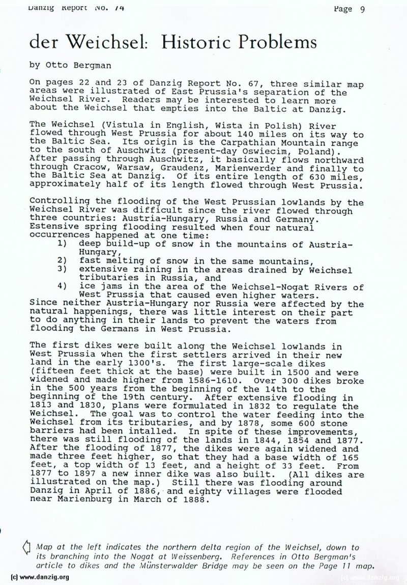
The first dikes were built along the Weichsel lowlands in West Prussia when the first settlers arrived in their new land in the early 1300’s. The first large—scale dikes (fifteen feet thick at the base) were built in 1500 and were widened and made higher from 1586-1610. Over 300 dikes broke in the 500 years from the beginning of the 14th to the beginning of the 19th century. After extensive flooding in 1813 and 1830, plans were formulated in 1832 to regulate the Weichsel. The goal was to control the water feeding into the Weichsel from its tributaries, and by 1878, some 600 stone barriers had been intalled. In spite of these improvements, there was still flooding of the lands in 1844, 1854 and 1877. After the flooding of 1877, the dikes were again widened and made three feet higher, so that they had a base width of 165 feet, a top width of 13 feet, and a height of 33 feet. From 1877 to 1897 a new inner dike was also built. (All dikes are illustrated on the map.) Still there was flooding around Danzig in April of 1886, and eighty villages were flooded near Marienburg in March of 1888.
Map at the left indicates the northern delta region of the Weichsel, down to its branching into the Nogat at IVeissenberg. References in Otto Bergman’s article to dikes and the ‘4iinsterwalder Bridge may be seen on the Page 11 map.
Danzig Report Vol. 1 - Nr. 74 - January - February - March - 1992, Page 9.
Hits: 2116
Added: 01/07/2015
Copyright: 2024 Danzig.org