Third Reich Corridor Propaganda
Three Maps of the Corridor - Similar but Different:
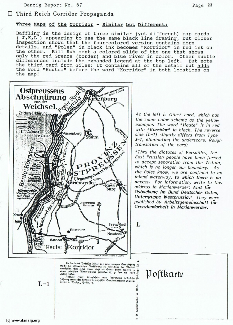
Baffling is the design of three similar (yet different) map cards ( J,K,L ) appearing to use the same black line drawing, but closer inspection shows that the four-colored version contains more details, and “Polen” in black ink becomes “Korridor” in red ink on the other. Bill Ruh sent a colored slide of the one that shows only the red Grenze (border) and blue river in color. Other subtle differences include the expanded legend at the top left. But note the third card from Giles: It contains all of the detail but adds the word “Heute:” before the word “Korridor” in both locations on the map!
At the left is Cues’ card, which has the same color scheme as the yellow example. The word “Heute” is in red with “Korridor” in black. The reverse side (L—1) slightly differs from Type J-1, eliminating the underscore. Rough translation of the card:
“Thru the dictates of Versailles, the East Prussian people have been forced to accept separation from the V/s tub, which is no longer our boundary. As the Poles know, we are confined to an inland waterway, to which there is no access. For in formation, write to this address in Marienwerder: Amt ftr Ostwthung im Bund Deutscher Os ten, Untergruppe Westprussia.” They were published by Arbeitsgemeinschoft f”ur Grenzlonclorbeit in Marienwercjer.
Danzig Report Vol. 1 - Nr. 67 - April - May - June - 1990, Page 23.
Hits: 1553
Added: 29/06/2015
Copyright: 2024 Danzig.org